While London has taken pedestrianisation off the agenda, Brussels has created since 2015 one of the largest car-free zones in Europe.
The Museo del Camminare has explored this courageous and successful experience, showing how it is affecting the urban space and life.
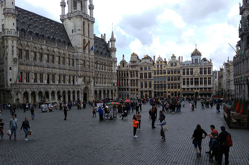
Read MoreOn 29 June 2015, Brussels officially inaugurated the pedestrianised zone locally known as Le Piétonnier – or Voetgangerszone in Dutch –, which was progressively expanded to encompass around 50 hectares, almost doubling the preexisting area without motor vehicles and thus becoming, to date, the largest in Europe after Venice’s. A few weeks before, the Mayor of Brussels, Yvan Mayeur, had explained the introduction of this car-free area as a way to put back the citizen at the centre of the city, letting the people repossess the public space.1
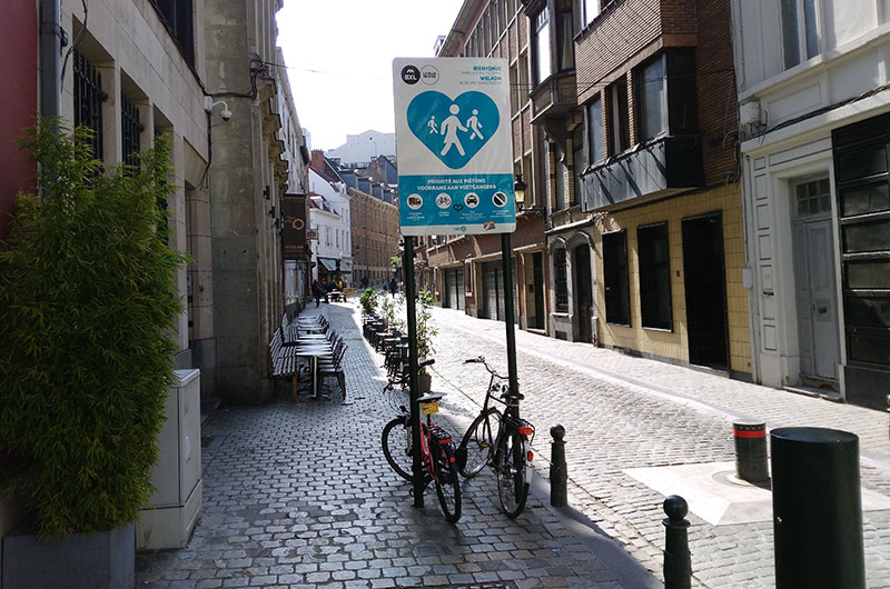
The plan was effectively implemented since the beginning and with very clear motivations: improve the life quality of the dwellers by reducing the negative effects of motor traffic. These include accident risks, unequal distribution of public space among users, noise and air pollution, with particular regard to carbon monoxide, nitrogen oxides, volatile organic compounds, and particulate matter. About the latter, for instance, 2014 data from air quality monitoring stations in urban Brussels (Molenbeek) showed that the annual mean concentration of PM2.5 (particulate matter smaller than 2.5 microns) exceeded the WHO recommended limit by 70 percent.2 Data for the 2012 had shown that the PM2.5 had been responsible of the premature death of 9,300 people in Belgium,3 a shocking figure that led to the decision taken in 2011 by the Brussels-Capital Region to cut the motor traffic by 20% by 2018 compared to 2001,4 and, consequently, to create the pedestrianised zone. Inside the latter, even parking is not allowed, transport of goods and people (taxis included) is allowed between 4am and 11am, and cyclists can ride if indicated.
At the core of Brussels’ pedestrianisation strategy is the idea that choosing to walk is choosing a future.5 Walking, according to this strategy, is very often a time- and stress-saving way of moving in a city and, on the top of that, is ‘very democratic’: thus, investing in walking is ‘investing in the equality of chances for everyone’.6 A positive attitude towards the social, environmental, and economic aspects of walking can trigger – in Brussels’ vision – a positive chain reaction: a good walkable environment attracts more walkers in a neighbourhood, therefore stimulating local economic activities and attracting more people in that area.7 In addition to the health and environment benefits, walking strengthens one’s ability to move around autonomously, of course with special attention paid to the needs of low mobility individuals and in conjunction with good public transport services. Finally, walking entails a denser and livelier interaction with the city.
But Brussels’ experience goes well beyond the liberation of large part of the city centre from motor vehicles for two other outstanding reasons.The first is that Le Piétonnier entails the recognition of the ‘right’ of pedestrians to ‘move around naturally’,8 a right much worth to be included into the seminal Pedestrian Bill of Rights that Breines and Dean drafted in 1974.9 The right to move around naturally is a milestone in the history of pedestrianisation and sets the pace for a new way of thinking the urban space. Who lives or visits Venice knows what moving around on foot naturally means: traditional safety zones such as pavements become obsolete, crosswalks as superfluous as pedestrian control signals, which, if present, should be exhibiting the words "Walk" perpetually. In sum, the straight segmented line that the urban planner has traced for the pedestrian will be replaced by the tangle of lines that pedestrians will draw “freefoot”. It is the subversion of a pedestrian-repressing urban order in which the walker is too often conceived as an obstacle rather than the protagonist. It is also a form of personal and urban liberation. If walking is to the urban system what the speech act is to the statements uttered – as De Certeau claims –,10 what beautiful stories the pedestrians will tell to a city in which moving around on foot becomes natural, and what exciting new relationships will be created between the city and the walkers!
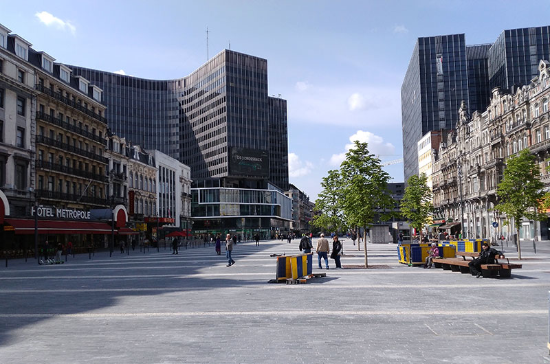
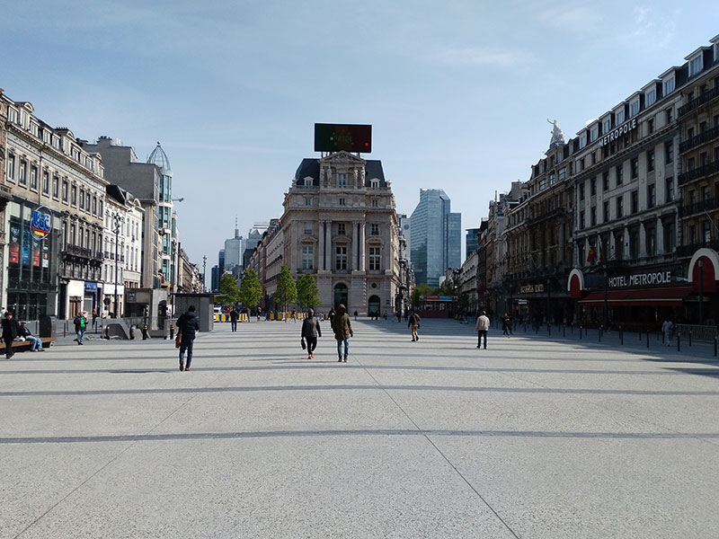
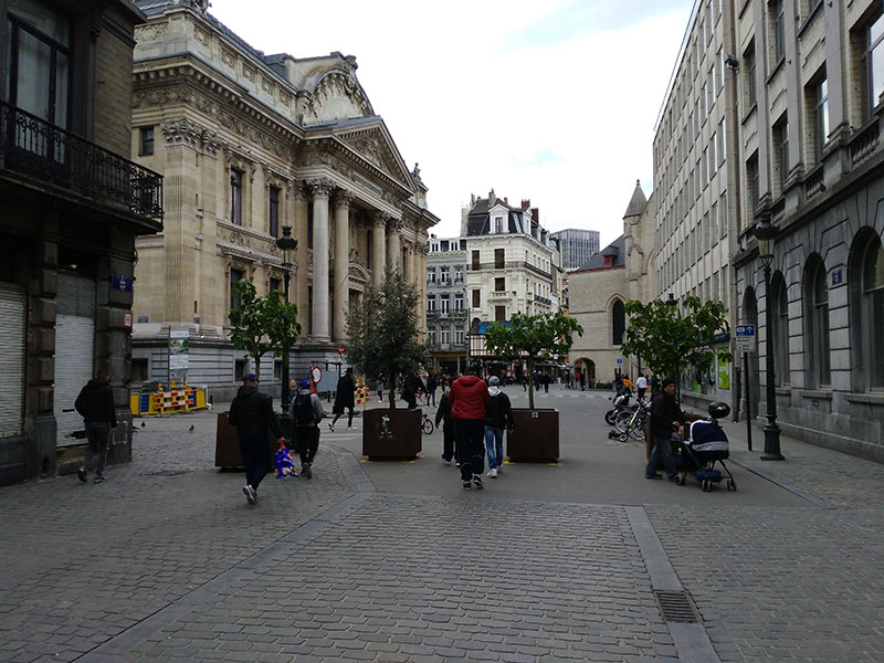
The second reason concerns the association between the implementation of the pedestrian zone and the publicly-funded beautification of the buildings located along it, with specific regard to Place de Brouckère (photo below, left), Boulevard Anspach (photo below, centre), Place de la Bourse (photo below, right), Rue de la Bourse, Place Fontainas, and Rue Henri Maus.
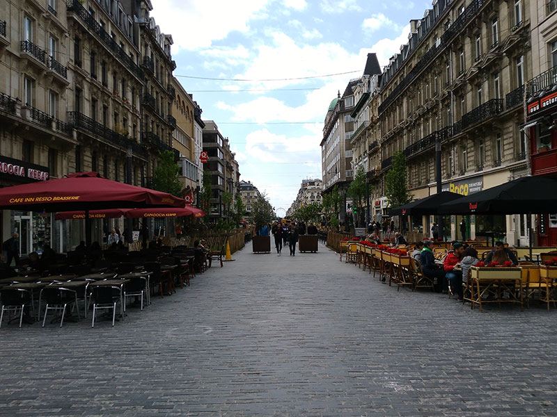
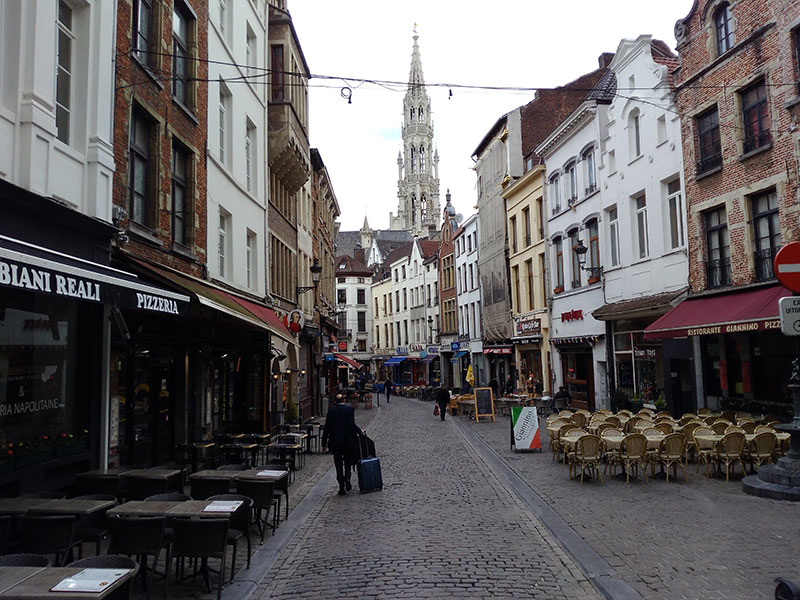
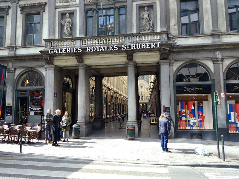
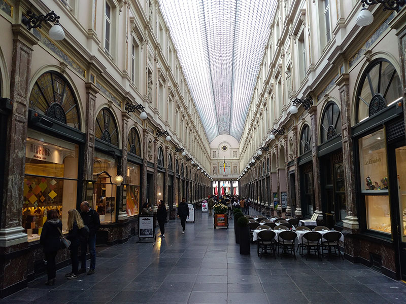
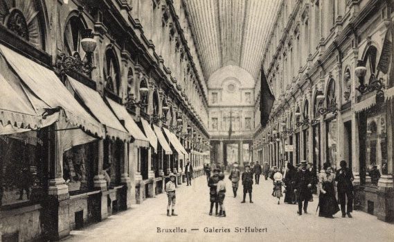
In addition, a sculpture trail was announced, possibly involving the British-Indian artist Anish Kapoor and the Belgian sculptor Arno Quinze. The project has the merit of revitalising the close relationship historically existing between art and architecture on the one hand, and, on the other hand, the promenade, a social event in which participants perform the act of covering a short distance, often back and forth, within a given space.11 This relationship goes back to the Classical Greek and Roman culture, in which urban dwellers used to stroll along magnificent portici and street stretches often embellished by artworks, and continued through the Italian Renaissance to the present, after spreading in the rest of Europe. Brussels’ choice of improving the scenery of the heart of the pedestrianised zone thus fits into the tradition that engendered urban phenomena such as Via del Corso in Rome, Cours-la-Reine in Paris, Paseo del Prado in Madrid, La Rambla in Barcelona, and many others still in use as promenade grounds. In Brussels’ current urban context, Boulevard Anspach – opened in 1871 as Boulevard Central – regains its central role, with its long pedestrianised stretch turned into a key axis of the car-free zone and provided with small green areas, benches, and wifi. With another reference to the city’s pedestrian tradition, Le Piétonnier encompasses the Saint-Hubert Royal Galleries (1847), the earliest example of pedestrian arcade complex extant in Europe (photos below).
As usually occurs in such circumstances, the City of Brussels’ pedestrianisation plan was initially met with some scepticism and not a little hostility, especially by the local shopkeepers, who feared a drop in their business as the possible consequence of a reduced access to the car-free area.12 One year after the introduction of the pedestrianised zone, however, a study quoted by the Minister of the Government of the Brussels-Capital Region, and responsible for Economy and Employment, Didier Gosuin, showed that, with the exception of the Rue Neuve, the attendance at commercial areas within the perimeter of the pedestrianised zone in the center of the capital had increased.13
In conclusion, in spite of some early criticism against the city administration for lack of communication and an aborted attempt to reduce the zone in 2016, Brussels’ pedestrian plan has since been going on convincingly, successfully reaching a point of no return.
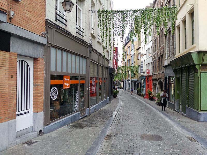
Moreover, Le Piétonnier has engendered positive reactions from the city dwellers in terms of participation in walking promotion initiatives. Among the latter is Stapas,14 a project created by the collaboration between the city administration and volunteer residents that produced a free guidebook and application identifying and mapping about 600km of car-free paths, lanes, and shortcuts in Brussels.
The map published by the Museo del Camminare shows Brussels’ existing pedestrianised areas and pedestrian thoroughfare.
Marked in indigo are the borders of the pedestrian city inside the city.
Cover image: crosswalk in front of the European Parliament (Rue de Trèves) after Pride 2019.
1. ‘Une pétition et un grand rassemblement à Bruxelles’, La Libre.be, 4 June 2015, URL: https://www.lalibre.be/regions/bruxelles/une-petition-et-un-grand-rassemblement-a-bruxelles-55708c9135709a87ac712e58
2. European Environment Agency, Air pollutant concentrations 2014. Dataset by cities, URL: https://www.eea.europa.eu/data-and-maps/data/air-pollutant-concentrations-at-station#tab-based-on-data
3. European Environment Agency, Premature deaths attributable to air pollution, URL: https://www.eea.europa.eu/media/newsreleases/many-europeans-still-exposed-to-air-pollution-2015/premature-deaths-attributable-to-air-pollution
4. Région de Bruxelles-Capitale, Plan de Mobilité Iris 2, Bruxelles, 2011, p. 40.
5. Plan piéton stratégique, Bruxelles, Région de Bruxelles-Capitale, 2013, p. 12.
6. Ibid.
7. Ibid.
8. Ibid.
9. Breines, Simon; Dean, William J., The Pedestrian Revolution. Streets without Cars, New York, Vintage Books, 1974.
10. De Certeau, Michel, The Practice of Everyday Life, Berkeley-Los Angeles, University of California, 1984, p. 97.
11. see Museo del Camminare, URL: http://www.museodelcamminare.org/progetti/passeggiata_italiana/pdf/The%20Italian%20Promenade.pdf
12. Salami, Jasmine, Piétonnier au centre de Bruxelles: des pour mais surtout des contre, RTBF, 26 June 2015, URL: https://www.rtbf.be/info/dossier/tout-savoir-sur-le-nouveau-pietonnier-bruxellois/detail_pietonnier-au-centre-de-bruxelles-des-pour-mais-surtout-des-contre?id=9007151
13. Piétonnier bruxellois: la fréquentation a augmenté par endroits, selon une étude, RTBF, 6 June, 2016, URL: https://www.rtbf.be/info/dossier/tout-savoir-sur-le-nouveau-pietonnier-bruxellois/detail_pietonnier-bruxellois-la-frequentation-a-augmente-par-endroits-selon-une-etude?id=9318288
14. URL: https://www.stapas.be/
© Museo del Camminare 2019, licensed under Creative Commons CC BY-NC-ND 4.0