Unlike what has been done in Germany since the 1950s, in Italy with the closure of many historical city centres to traffic since the 1960s, in Brussels, and in many North European cities, London has never taken pedestrianisation seriously. The abandonment of Oxford Street pedestrianisation plan in 2018 provides the most recent evidence of that.
The Museo del Camminare has reviewed London’s present and past pedestrian options and provides itineraries to those who want to walk in a carless environment.
Read MoreIn June 2018, the Westminster City Council announced that it had taken Oxford Street pedestrianisation plan ‘off the table for good’,1 thus missing a key opportunity to free from vehicles one of the most crowded street of London as well as one of the most polluted streets in the world, with possibly the highest levels of NO2 in the history of air pollution.2 The reason for the decision, according to the Council’s leader, was that ‘“the majority of its residents” were against the proposals to make it traffic-free’.3 What the Council decided to ignore, however, was that the majority of the respondents – people living in the neighbourhoods near Oxford Street – opposed pedestrianisation because they feared the displacement of motor vehicles into surrounding areas. Thus, why not enlarge the pedestrianised zone and improve the life of more people, instead of discarding the plan?
One month later, in July 2018, the Mayor of London published the Walking Action Plan,4 which aims to turn London into one of the most walkable cities of the world. The goal is to increase the number of end-to-end walking journeys from 6.4 million in 2018 to 7.5 million in 2024 mainly by promoting walking especially in schools, improving pedestrian crossing, and increasing road safety. Yet, the document does not include pedestrianisation in its active plan and barely mentions it, thus neglecting a powerful means to improve the quality of the urban life and reduce pollution.
According to new data published in early 2019 by the Mayor of London, two million Londoners – including more than 400,000 children – are living in areas which exceed legal limits for air pollution.5 London fails to meet EU guidelines on NO2 concentrations and WHO guidelines on particulate matter (PM) concentrations. Since the early 2000s, around 12.5 per cent of the total area of London – including central London – remains above the legal limit of 40 µg/m3. In Oxford Street, for example, the average NO2 concentration between August 2014 and August 2015 was more than 150 µg/m3, almost four times the legal limit.6 About the PM levels, they are legal only because the UK guideline levels do not reflect those set by the WHO, according to which 88 per cent of the total area of London has PM levels the limits. PM comprises fine particles of dust, soot and other materials, and exposure to PM pollution is linked to asthma, lung cancer, and respiratory and cardiovascular diseases.7 In 2010 only, a research by King’s College estimated that air pollution was responsible for up to 141,000 life years lost or the equivalent of up to 9,400 deaths in London and over 3,400 hospital admissions.8
Since 2003, the urban administration has taken action by charging a fee on most motor vehicles circulating in a specific area of central London (Congestion Zone) between 7.00am to 6.00pm from Monday to Friday, plus a newly introduced fee if those vehicles do not meet certain emission standards (ULEZ). While the latter seems to have good chances to reduce pollution (and to boost the purchase of new cars), the former’s impact is much more controversial. Due to a rise in online shopping, commercial vehicles have multiplied in central London’s streets to the point that congestion has once again exceeded pre-congestion charge levels.9 Private hire vehicles like Uber have also multiplied, and as soon as they ceased to be exempt from paying the charge in 2019, they immediately increased the cost of journeys in central London by one pound. Hence pollution increases and, on the top of that, consumers bear the cost of congestion charges.
In such a dramatic situation, one would expect the administration of London to focus its strategy directly on people, and not only on cars. In addition to continuing to charge vehicles, why not "simply" remove vehicular traffic from city streets? Couldn’t there be room for pedestrian areas within the 1,570 square kilometres which host a population of almost 9 million and turn Greater London into the largest city in the United Kingdom and in the European Union?
Is it so difficult to reduce pollution and improve the quality of people’s life by putting cars aside, instead of people? To think of a street as a human and cultural place, or, as Bernard Rudofsky wrote in his Streets for People, ‘the matrix: urban chamber, fertile soil and breeding ground’?
In the case of London, the answer, unfortunately, is yes. Unlike what has been done in Germany since the 1950s, when Kassel, Stuttgart and Kiel reclaimed streets from cars thus beginning a process that later involved many other German cities; in Italy, with the closure of many historical city centres to traffic since the 1960s; in Brussels, which is radically changing its city centre by successfully introducing a pedestrianisation plan; and in many North European cities, London has never taken pedestrianisation seriously. To date, this is limited to very few cases, dealt with in the following section.
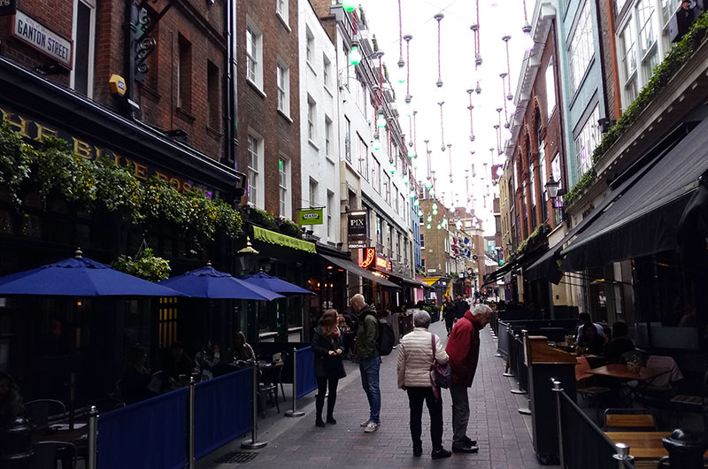
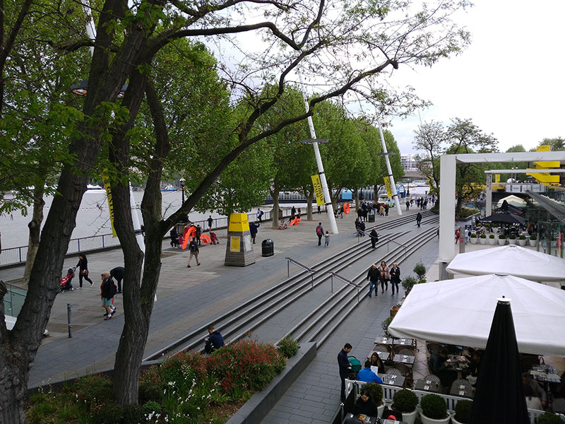
However, alongside the promotion of cycling, pedestrianisation should be seen as the most effective strategy to ameliorate the quality of residents and tourists by increasing their safety and reducing pollution rapidly and effectively. The hope for the future is that the Council will take pedestrianisation as seriously as it deserves. For instance, as Zaha Hadid Architects do. Their Walkable London10 is a powerful strategy to turn London into a real walking city by creating four huge pedestrianised zones – which broadly include the City, Clerkenwell, large part of the West End, and Waterloo – interconnected by a vast network of pedestrian routes, encompassing Oxford Street and Charterhouse Street.
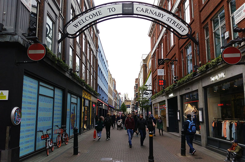
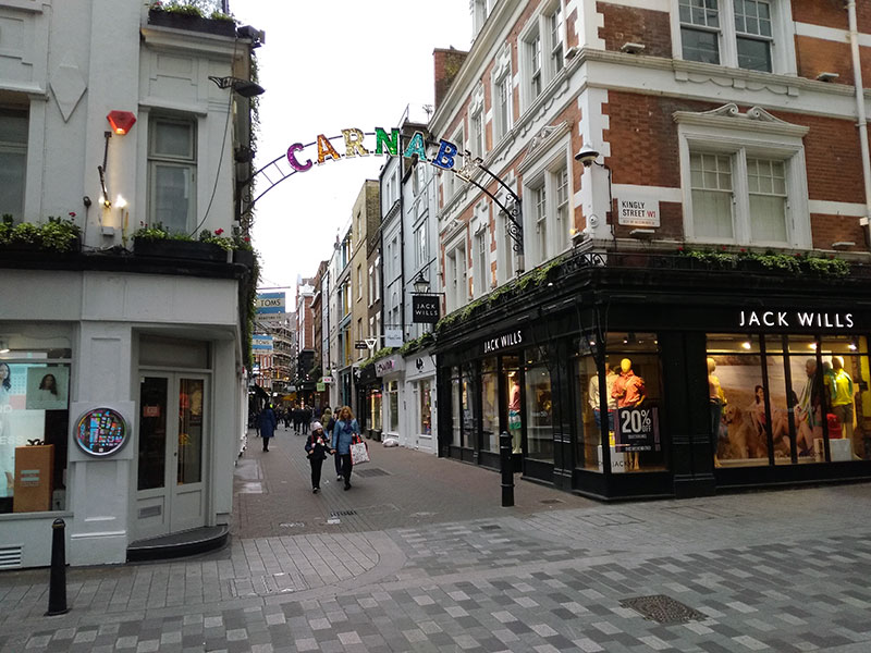
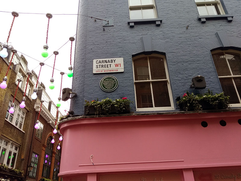
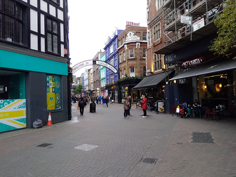
The 1960s Swinging London’s icon Carnaby Street was pedestrianised in 1973, about twenty years after beginning to host fashionable clothes shops and boutiques. Before, it had hosted night clubs such as the Florence Mills Social Parlour, established in the 1930s at No. 50,11 a key meeting place of the London’s Black community. Named after the black actress Florence Mills, it was run by Marcus Garvey’s first wife, Amy Ashwood, and the Trinidadian calypso singer Sam Manning.12 It was followed in the 1950s by the racially mixed Sunset Club, and in 1962 by the The Roaring Twenties, which became Columbo’s in the 1970s. The street’s international fame, however, is mostly due to fashion, and particularly to the mod-style clothes shop Lord John opened in the 1960s at No. 43; to a branch of Portobello Road’s I Was Lord Kitchener’s Valet opened here in 1967 and selling military uniforms from Victorian era; and to the women’s boutique Lady Jane, opened at No. 29 by Henry Moss in 1967 and famous for the girls changing in the shop windows. The street also boasted one of the earliest vegetarian restaurants opened in the United Kingdom, Cranks, established in 1961 at No. 22 by David and Kay Canter and Daphne Swann. Since the beginning of the 1970s, the pedestrianisation of the street has proved a great success with traders and the public, providing a key contribution to the character of the area.
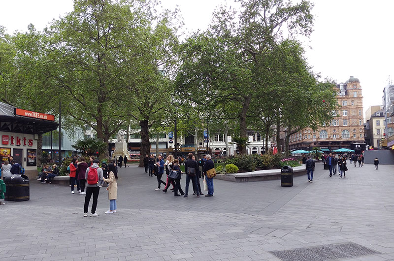
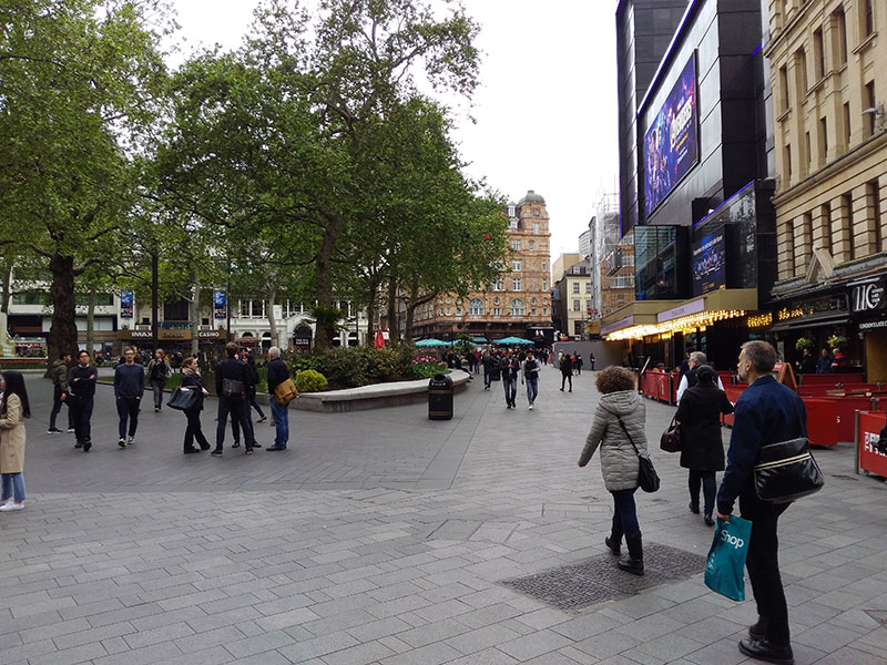
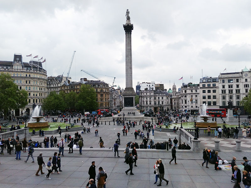
In the 1980s, Leicester Square was turned into a pedestrian precinct, and in 2003, Norman Foster’s replanning of Trafalgar Square entailed the pedestrianisation of the north side. In spite of having been much disputed, this transformation proved ‘immensely popular with pedestrians’ according to The Times, which hailed it as a triumphant liberation of the area from the ‘curse of five-lane traffic’.13
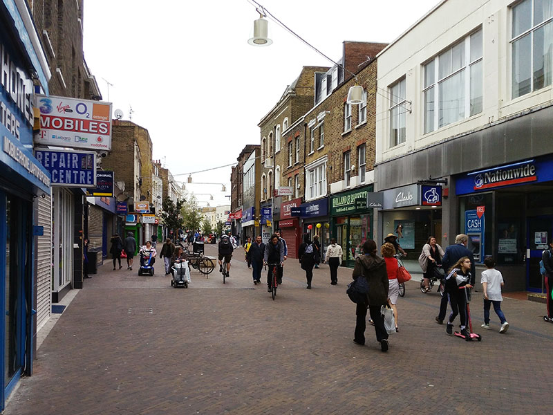
The cases of Carnaby Street and Trafalgar Square provide compelling evidence of the fact that, no matter how difficult and controversial pedestrianisation may be in the planning phase, once it is implemented, it makes going back to the previous situation unthinkable and unacceptable. However, like many other European cities, London has become so car-minded that challenging this attitude proves very demanding, as the recent case of Narrow Way demonstrates. In 2013, Hackney Council’s plan to pedestrianise the northernmost section of Mare Street, known as Narrow Way (photo below, left), initially met a mixed reaction, which included a protest march in 2014 and a petition signed by thousands of locals and particularly supported by shopkeepers. Out of the 747 respondents in the consultation undertaken by the Council in 2013, 320 were broadly supportive of the pedestrianisation, 269 opposed changes to the bus network, and 158 were neutral. Since 2015, however, no more protests were held and the street’s car-freedom is a successful fait accompli.
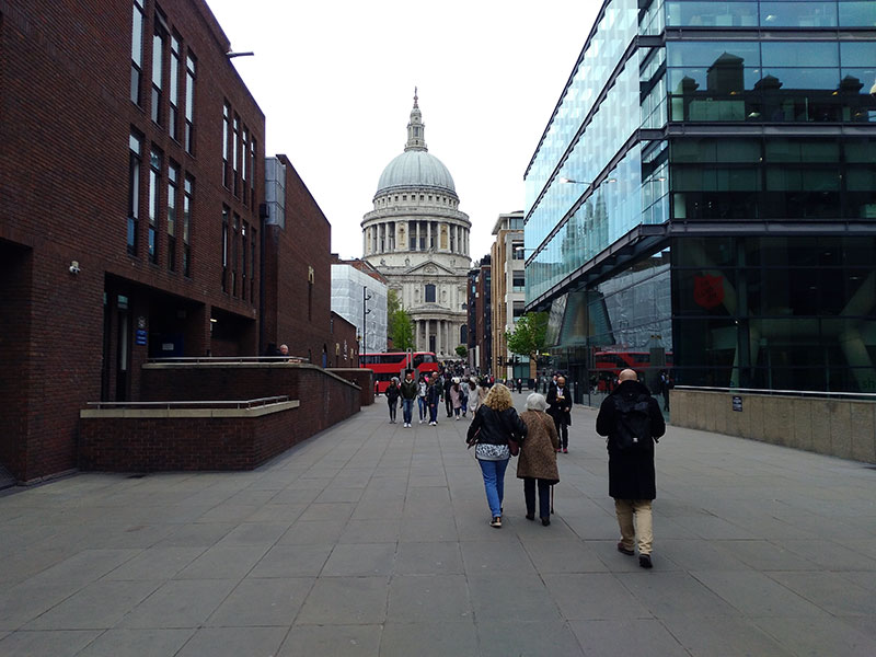
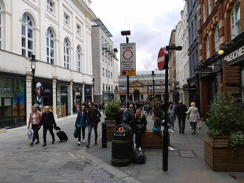
Other smaller pedestrianised areas include Peter’s Hill walkway (photo below, centre), linking St Paul’s Cathedral with the Thames, and leading to the London Millennium Footbridge opened in June 2000; Covent Garden (photo below, right); the recent King’s Boulevard and Granary Square at King’s Cross; the Mitsubishi-owned Paternoster Square; short streets such as Sicilian Avenue, Cosmo Place and Ezra St; and stretches of streets including South Molton St; St Cristopher’s Place; and Neils St.
In spite of the fact that London’s poor performance in the provision of car-free areas needed remedying as early as forty years ago,14 the urban administration has traditionally seen the pedestrian issue in terms of circulation rather than a key opportunity to turn urban spaces into people-friendly, pleasant, healthy, and safe environments. In other words, it has manifestly privileged pedestrians’ moving activities over their stationary activities. It is in this framework that the focus was given in the past to the separation of pedestrian and vehicular circulation. In the early 1960s, this idea took the form of pedways, a system of elevated pedestrian walkways across central London. The video below is an excerpt from The Growing Town. A Look at the Future, which the BBC broadcasted in 1961 (subtitles by Museo del Camminare).
Very interestingly, according to Jonathan Glancey, one of the great inspiration for this system was Venice, which with its bridges and walkways takes people over canals very effectively and quickly.15 In London, it was the ‘utopian dream’ of providing a ‘perfect walking environment for walkers’, according to Nicholas Rudd-Jones, whereas, according to Peter Rees, chief planner of the City of London from 1985 to 2014, ‘it was simply about getting people out of the way in order to speed up traffic flow’.16 It was, however, a top-down plan, which never met the favour of pedestrians as it segregated them from the street-level urban life and added the burden of climbing stairs. As a result, the implementation of the plan was substantially limited to two comprehensively and futuristically planned 1960s developments: the Barbican Complex and the Thamesmead.
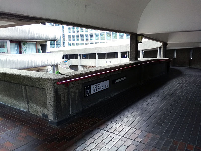
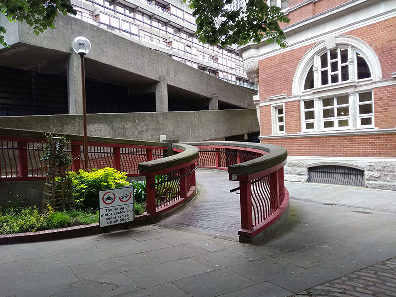
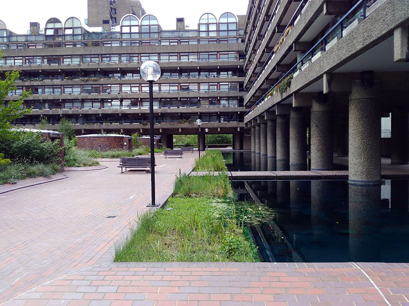
Characterised by its concrete Brutalist aesthetics, the Barbican still offers the pedestrian the experience of walking on its extensive network of highwalks, interconnecting the three residential tower blocks and bridging over Aldersgate Street and the Rotunda. By taking the pedways linking Golden Lane to the Museum of London one has also the chance to cross one of London’s least known pedestrianised square, Ben Jonson Place, which lies above the street level and boasts a little pond, gardens, fountains, and benches.
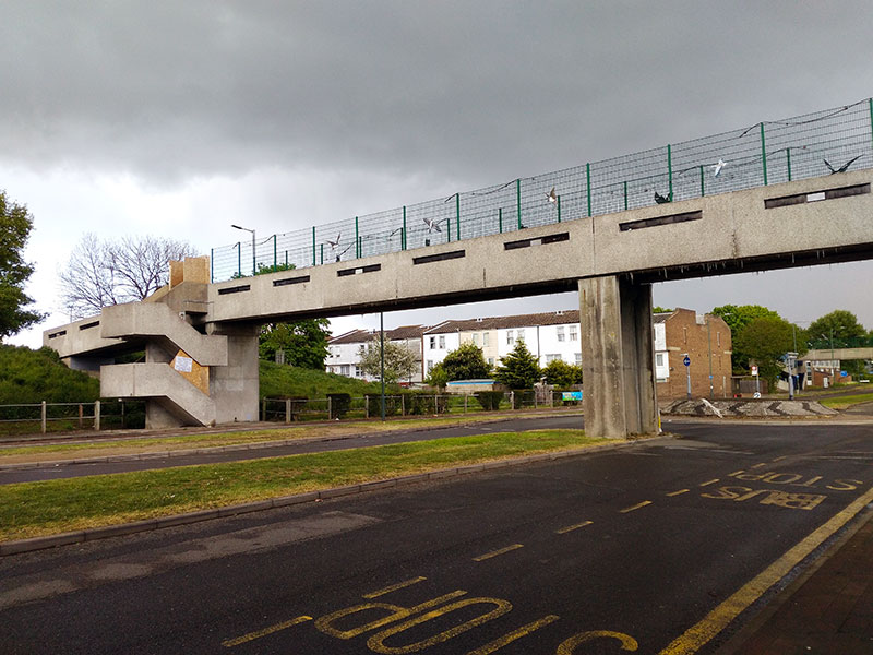
In the late 1960s, the Greater London Council’s architects introduced the elevated walkway system in the planning of Thamesmead, an ambitious project that intended to provide 60,000 people with new modern homes. Inspired to the same principle of the segregation of motorists and pedestrians, the walkways linked the development’s residential units, schools, shops, offices and recreational spaces (photo below, left and centre). Since the 1970s, however, the living conditions began to deteriorate and the levels of crime raised. Stanley Kubrick significantly chose it as a location for his 1971 A Clockwork Orange (photo below, right). What the Council conceived as a model for housing development and advertised as ‘A Place in London’s Future’ turned out to be a failure.


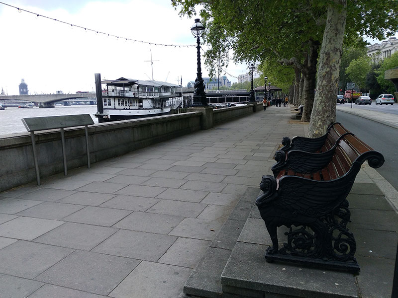
Thames Path, a 128km pedestrian thoroughfare on North and South Bank. In recent years the path has benefited from many improvements involving public and, especially in the North Bank, private spaces. The Queen’s Walk, part of the Jubilee Walkway celebrating Queen Elizabeth II’s Silver Jubilee, allows walking along the city’s southern bank for the river, from Tower Bridge to Lambeth Bridge, flanking key cultural landmarks such as Tate Modern, National Theatre, BFI, Southbank Centre, Hayward Gallery, and Royal Festival Hall (photo below, left). Particularly fascinating is Victoria Embankment’s pedestrian walkway, built in 1870 and furnished with imposing black cast-iron benches and lampposts (photo below, centre). This was one of the first street in London to be lit with the electrical arc lamp (1878).
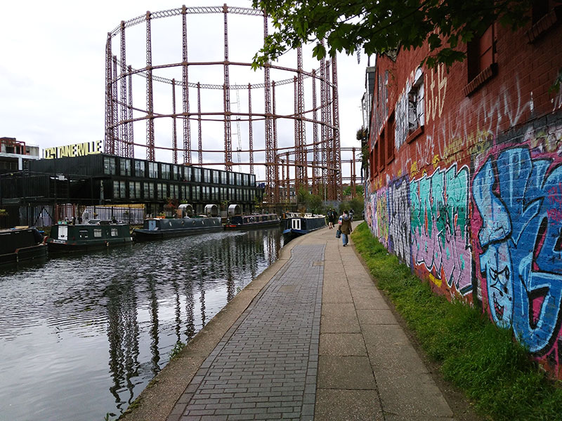
The 8.5-mile (almost 14-kilometre) long towpath along the Regent’s Canal (photo below, right) is another beautiful urban walking space, which runs from Paddington to Limehouse.
The map published by the Museo del Camminare shows London’s existing pedestrianised areas and pedestrian thoroughfare. In addition, it contributes to the city’s walkability by proposing a strollway which links Whitechapel and Marble Arch allowing a pedestrian to walk on low-traffic streets without renouncing the pleasure of vibrant urban environments such as Hoxton Square, Exmouth Market, Mount Pleasant, Rivington Street.
Marked in blue (Regent's Canal), green (Whitechapel-Marble Arch strollway), chocolate (Thames Path, North Bank), and dark red (Thames Path, South Bank), these four lines trace the walkbeats of London.
Cover image: graphics on the pavement outside Wieden + Kennedy Agency, 16 Hanbury St, London.
1. BBC News, Oxford Street Pedestrianisation Plans Ditched, 8 June 2018, URL: http://www.bbc.co.uk/news/uk-england-london-44405730
2. Carslaw, David, Recent Findings from Comprehensive Vehicle Emission Remote Sensing Measurements, Frontiers in Air Quality Science, conference paper, London, Centre for Environment & Health, 2014, p. 4.
3. BBC News, op. cit.
4. Mayor of London, Walking Action Plan. Making London the World’s Most Walkable City, London, Transport for London, July 2018.
5. Mayor of London, Latest Data Shows Two Million Londoners Living with Illegal Toxic Air, 1 April 2019, URL: http://www.london.gov.uk/press-releases/mayoral/two-million-londoners-live-with-illegal-toxic-air
6. Howard, Richard, Up in the Air. How to Solve London’s Air Quality Crisis, London, Policy Exchange-Capital City Foundation, Part 1, 2015, p. 17.
7. Ibid., p. 35.
8. Walton, H. et al., Understanding the Health Impacts of Air Pollution in London, London, King’s College London for GLA and TFL, 2015.
9. O’Sullivan, Feargus, London Puts a High Price on Driving Older, Polluting Cars, Citylab, 5 April 2019, URL: http://www.citylab.com/transportation/2019/04/central-london-ulez-ultra-low-emissions-zone-car-congestion-charge/586561/
10. Zaha Hahid Architects, Walkable London. Boosting the Urban Prosperity Engine, London, 2018, URL: http://www.walkablelondon.co.uk/
11. Carnaby Street in Historic England, URL: http://www.historicengland.org.uk
12. Carnaby Echoes, URL: http://www.carnabyechoes.com
13. Cork, Richard, Get Hip in the Square, The Times, 29 July 2003, URL: http://www.thetimes.co.uk/article/get-hip-in-the-square-g3mt8kt2w6r
14. Roberts, John, Pedestrian Precincts in Britain, London, Transport and Environment Studies, 1981, p. 6.
15. Glancey, Jonathan, interview, in Bevan Lee, Chris, The Pedway. Elevating London, documentary, London, City of London, 2013.
16. Rees, Peter, interview, in Bevan Lee, op. cit.
© Museo del Camminare 2019, licensed under Creative Commons CC BY-NC-ND 4.0